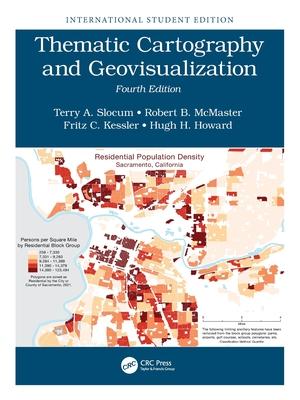
The fourth edition of a well-established book in cartography explores the continued evolution of the Internet and Web 2.0 and captures the analysis and visualization of Big Data. Thoroughly revised, this textbook equips educators and benefit students with the most valuable up-to-date learning resource available in the cartographic field.
| FindBook |
|
有 1 項符合
Thematic Cartography and Geovisualization: International Student Edition的圖書 |
 |
$ 4137 | Thematic Cartography and Geovisualization: International Student Edition
作者:Slocum 出版社:CRC Press 出版日期:2024-04-19 語言:英文 規格:平裝 / 614頁 / 27.94 x 20.96 x 3.15 cm / 普通級/ 初版  看圖書介紹 看圖書介紹
|
|
|
內容簡介
作者簡介
Terry Slocum is an Emeritus Professor with the University of Kansas where he taught cartography and statistics for 35 years, and chaired the Department of Geography for 8 years. His research interests have included data exploration, map animation, visualizing uncertainty, stereoscopic displays, history of thematic mapping, and color usage on maps. He has published in numerous refereed journals, including Cartography and Geographic Information Science, Cartographica, The Cartographic Journal, Annals of the American Association of Geographers, Journal of Geoscience Education, and Journal of Geography. Professor Slocum has been affiliated with six grants from the U.S. National Science Foundation, and received two Teacher Appreciation Awards from the Center for Teaching Excellence at the University of Kansas. He has chaired 14 dissertation and thesis committees and served on more than 75 dissertation and thesis committees.
Robert B. McMaster is Vice Provost and Dean of Undergraduate Education, and Professor of Geography, at the University of Minnesota--Twin Cities. His research interests include automated generalization, environmental risk assessment, Geographic Information Science and society, and the history of U.S. academic cartography. He has authored or edited seven books on cartography and GIS, and his papers have been published in The American Cartographer, Cartographica, The International Yearbook of Cartography, Geographical Analysis, Cartography and GIS, and the International Journal of GIS. He served as editor of the journal Cartography and Geographic Information Systems from 1990-1996. He has served as President of the United States’ Cartography and Geographic Information Society, President of UCGIS, and Vice President of the International Cartographic Association. Robert served a three-year term on the National Research Council’s Mapping Science Committee (2005-2008). In 2010, he was named GIS Educator of the Year by the University Consortium on Geographic Information Science. In 2013 he was named Fellow of UCGIS.
Fritz Kessler is a Teaching Professor with Penn State. His teaching interests span cartography, statistics, and geography of health. His research focus spans several topics in cartography that include map projections, geometric and geopotential datums, history of thematic mapping, and data exploration. He has published in numerous refereed journals, including Cartography and Geographic Information Science, Cartographica, Cartographic Perspectives, Annals of the American Association of Geographers, Journal of Geography, and GeoJournal. He also coauthored a book with Dr. Sarah Battersby (at Tableau) titled Working with Map Projections: A Guide to their Selection. He is a former President of the North American Cartographic Information Society (NACIS) and a board member to the Cartography and Geographic Information Society (CaGIS). His cartographic background is not limited to academia but has evolved through a several professional positions including Ohio University’s Cartographic Center, USGS Water Resource Division, Intergraph Corporation, R. R. Donnelley and Sons, and the University of Kansas’ T. R. Smith Map Library.
Hugh Howard is a professor of GIS at American River College in Sacramento, California, which hosts one of the largest GIS programs in the nation. He is the GIS Coordinator, Geosciences Department Chair, and currently teaches five GIS courses, including Cartographic Design for GIS. Hugh earned his Ph.D. in Geography from the University of Kansas specializing in cartographic design, and developed an expert system software application to aid students in designing better maps. In 2019, he won an Excellence in Education award from the California Geographic Information Association (CGIA), and a Lifetime Achievement in Geospatial Two-Year College Education award from the GeoTech Center (an NSF-funded National Geospatial Technology Center of Excellence). Hugh has worked as a cartographer for the U.S. Forest Service, the City of San Francisco, CB Richard Ellis, and Cartographics. He also taught GIS and managed GIS labs at Stanford University and San Francisco State University.
|


